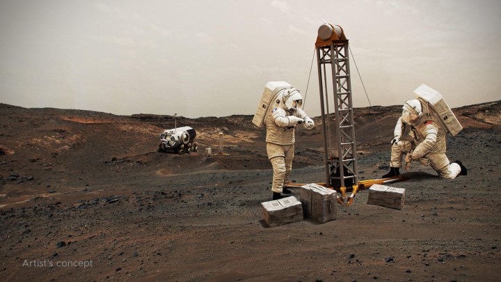
One of the challenges of sending human explorers to Mars is that, due to the logistics of the journey, they will have to be on the planet’s surface for considerably longer than the missions of a few days which have been sent to the moon in the past. That means future explorers will need access to resources like food, water, and oxygen — and rather than having to carry months’ worth of supplies through space, it’s far more efficient to find ways to produce those resources on Mars itself.
That’s the idea behind searching for water ice deposits on Mars. There’s plenty of ice on the surface around the planet’s poles, but most mission concepts are more focused on the planet’s equatorial region. The good news is that there is ice present in these areas too, but the bad news is that it’s primarily located below the surface and is thus hard to locate.
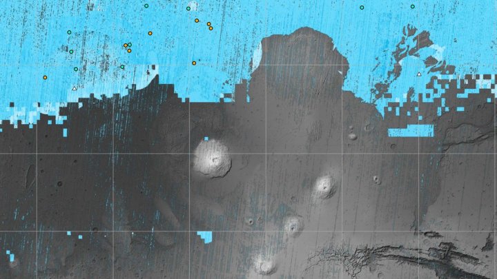
Now, a NASA project called Subsurface Water Ice Mapping or SWIM has released a new set of Mars maps, showing the locations of subsurface ice. “If you send humans to Mars, you want to get them as close to the equator as you can,” said Sydney Do, SWIM project manager at NASA’s Jet Propulsion Laboratory, in a statement. “The less energy you have to expend on keeping astronauts and their supporting equipment warm, the more you have for other things they’ll need.”
Previous versions of the maps used a combination of data from various missions, combining data such as radar readings and indications of hydrogen. This allowed the researchers to locate the most likely areas of ice beneath the surface. The newest maps use high-resolution cameras on the orbiting Mars Reconnaissance Orbiter mission to look at regions where meteoroids had struck the planet and created impact craters that revealed the ice beneath, proving its presence.
“These ice-revealing impacts provide a valuable form of ground truth in that they show us locations where the presence of ground ice is unequivocal,” said Gareth Morgan, SWIM’s co-lead at the Planetary Science Institute. “We can then use these locations to test that our mapping methods are sound.”
As well as being vital for future crewed missions, the presence of ice is relevant to the search for potential ancient life on the planet too. “In the harsh environment of the Martian surface, ice can act as a radiation shield. Biosignatures of past life in many ways are more susceptible to ionizing radiation damage than actual living organisms. So ice could preserve signatures of ancient life,” Morgan said. “Also if you can melt ice you have water of course, which is believed to be essential to life. So, in the very big picture, our maps will be of interest to exobiology studies.”
Editors’ Recommendations